About
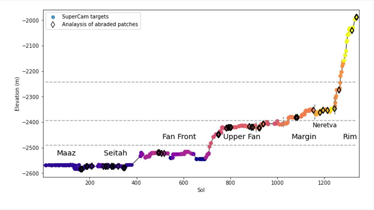
This graph shows the relative elevation of various sampling sites visited by NASA's Perseverance Mars rover. Colored dots along the line represent targets where data was collected by the rover's SuperCam laser instrument; the colors correspond to different regions within Jezero Crater, which are labeled. The black diamonds represent locations where the rover's abrasion tool was used to collect data on rock composition. The x-axis indicates the sol, or day, of the rover's mission, and the y-axis shows elevation in meters. Jezero Crater sits about 8,530 feet (2,600 meters) below reference level (the equivalent for "sea level" on Mars, which does not have any oceans), which is why the numbers a — NASA JPL · 2024. ABD devlet eseri: kamu mali, ticari islerde de serbestce kullanilabilir.
Source and licence
This work is public domain or openly licensed. The licence terms are published by the source.
How do I open it?
Use the Shopy 101 app to download it or read it in place. Anything you add to your library stays the same on every device.