About
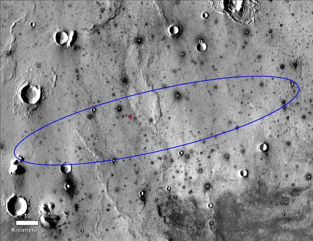
The red dot marks the final landing location of NASA's InSight lander in this annotated image of the surface of Mars, taken by the THEMIS camera on NASA's 2001 Mars Odyssey orbiter in 2015. A version with latitude and longitude is also available. The landing ellipse on this map covers an area within which the spacecraft had about a 99 percent chance of landing when targeted for the center of the ellipse. It is about 81 miles (130 kilometers) long, generally west to east, and about 17 miles (27 kilometers) wide. The base map is a mosaic of daytime thermal images from the Thermal Emission Imaging System (THEMIS) on NASA's Mars Odyssey orbiter. THEMIS was developed and is operated by Arizona St — NASA JPL · 2018. ABD devlet eseri: kamu mali, ticari islerde de serbestce kullanilabilir.
Source and licence
This work is public domain or openly licensed. The licence terms are published by the source.
How do I open it?
Use the Shopy 101 app to download it or read it in place. Anything you add to your library stays the same on every device.