About
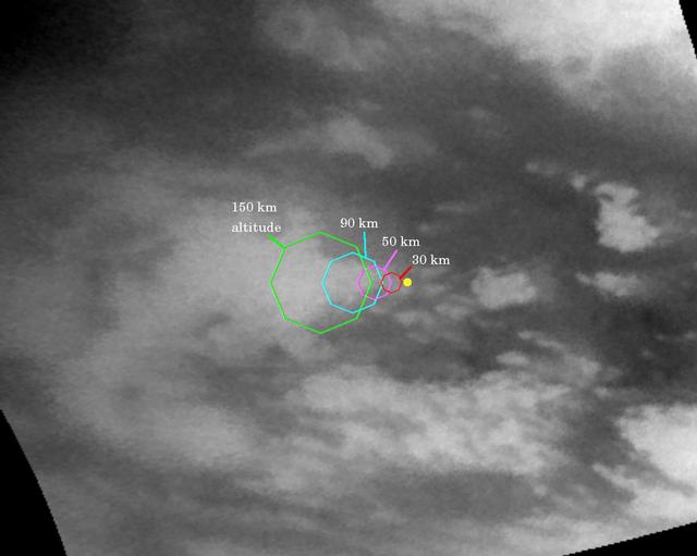
This map illustrates the planned imaging coverage for the Descent Imager/Spectral Radiometer, onboard the European Space Agency's Huygens probe during the probe's descent toward Titan's surface on Jan. 14, 2005. The Descent Imager/Spectral Radiometer is one of two NASA instruments on the probe. The colored lines delineate regions that will be imaged at different resolutions as the probe descends. On each map, the site where Huygens is predicted to land is marked with a yellow dot. This area is in a boundary between dark and bright regions. This map was made from the images taken by the Cassini spacecraft cameras on Oct. 26, 2004, at image scales of 4 to 6 kilometers (2.5 to 3.7 miles) per pi — NASA JPL · 2005. ABD devlet eseri: kamu mali, ticari islerde de serbestce kullanilabilir.
How do I open it?
Use the Shopy 101 app to download it or read it in place. Anything you add to your library stays the same on every device.