About
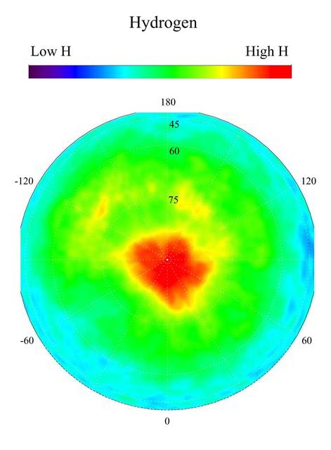
This gamma ray spectrometer map centered on the north pole of Mars is based on gamma-rays from the element hydrogen. In this region, hydrogen is mainly in the form of water ice. Regions of high ice content are shown in red and those low in ice content are shown in blue. The very ice-rich region at the north pole is due to a permanent polar cap of water ice on the surface. Elsewhere in this region, the ice is buried under several to a few tens of centimeters of dry soil. The sub-surface ice is not uniformly distributed in the north, but varies with both latitude and longitude. In the north, the soil is well over 50 percent ice, which is more than can be accommodated by just filling the pore s — NASA JPL · 2003. ABD devlet eseri: kamu mali, ticari islerde de serbestce kullanilabilir.
Source and licence
This work is public domain or openly licensed. The licence terms are published by the source.
How do I open it?
Use the Shopy 101 app to download it or read it in place. Anything you add to your library stays the same on every device.