About
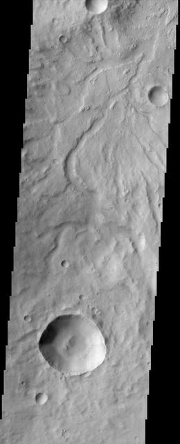
This image by NASA Mars Odyssey spacecraft shows the rugged cratered highland region of Libya Montes, which forms part of the rim of an ancient impact basin called Isidis. This region of the highlands is fairly dissected with valley networks. There is still debate within the scientific community as to how valley networks themselves form: surface runoff (rainfall/snowmelt) or headward erosion via groundwater sapping. The degree of dissection here in this region suggests surface runoff rather than groundwater sapping. Small dunes are also visible on the floors of some of these channels. http://photojournal.jpl.nasa.gov/catalog/PIA04008 — NASA JPL · 2002. ABD devlet eseri: kamu mali, ticari islerde de serbestce kullanilabilir.
Source and licence
This work is public domain or openly licensed. The licence terms are published by the source.
How do I open it?
Use the Shopy 101 app to download it or read it in place. Anything you add to your library stays the same on every device.